
1951 Map of Bokhoma
USGS Topo · Published 1951About this map
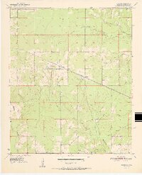
The St Louis San Francisco railroad cuts a diagonal line through McCurtain County, serving as the primary infrastructure for the small community of Bokhoma. Situated in the southeastern corner of the state, this area is defined by its complex drainage network, where North Caney Creek, Middle Caney Creek, and South Caney Creek converge. The landscape is dotted with several family-named landmarks and rural institutions that anchored the local population, including the Bokhoma Cem and the settlement of Moon.
Find a feature on this map
16 named features on this map. Tap any name to fly to it.
Don’t see what you’re looking for? This feature index may not catch every label — zoom into the map to look around manually.
Map Details
Editions of this 1951 Bokhoma Map
2 editions found
Other maps of this area

1950 · De Kalb NW
USGS Topo · 1:24,000

1950 · Shults
USGS Topo · 1:24,000

1950 · Haworth
USGS Topo · 1:24,000

1950 · Tom
USGS Topo · 1:24,000

1950 · Goodwater
USGS Topo · 1:24,000

1950 · Bokhoma
USGS Topo · 1:24,000

1951 · De Kalb NW
USGS Topo · 1:24,000

1951 · Haworth
USGS Topo · 1:24,000

1951 · Tom
USGS Topo · 1:24,000

1951 · Shults
USGS Topo · 1:24,000