
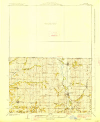
1927 Map of Bolckow
USGS Topo · Published 1927About this map
Bolckow and Rosendale serve as the primary rail hubs for this agricultural pocket of northwest Missouri during the mid-1920s. The landscape is defined by the winding course of the One Hundred and Two River, which creates a natural corridor for the Chicago Burlington and Quincy railroad. Further east, the Chicago Great Western tracks cut through Wyeth and Cawood, illustrating the dense rail competition of the era.
Find a feature on this map
47 named features on this map. Tap any name to fly to it.
Don’t see what you’re looking for? This feature index may not catch every label — zoom into the map to look around manually.
Map Details
Editions of this 1927 Bolckow Map
2 editions found
Other maps of this area

1885 · Atchison
USGS Topo · 1:125,000

1888 · Atchison
USGS Topo · 1:125,000

1893 · Atchison
USGS Topo · 1:125,000

1923 · Clarksdale
USGS Topo · 1:62,500

1924 · St. Joseph
USGS Topo · 1:62,500

1925 · Clarksdale
USGS Topo · 1:62,500

1925 · Stanberry
USGS Topo · 1:62,500

1926 · Saint Joseph
USGS Topo · 1:62,500

1926 · Oregon
USGS Topo · 1:62,500

1926 · Maitland
USGS Topo · 1:62,500