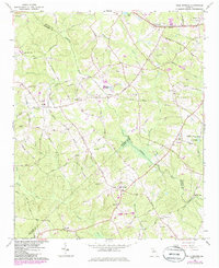
1964 Map of Bold Springs
USGS Topo · Published 1985About this map
The Apalachee River and Alcovy River define this rural landscape where the boundaries of Barrow, Gwinnett, and Walton counties converge. This mid-1960s environment is characterized by family-named infrastructure and small community hubs like Bold Springs and Whistleville. Researchers will find a high concentration of localized landmarks such as Harbin Community House and the enigmatic Lost City located near the riverbank.
Find a feature on this map
71 named features on this map. Tap any name to fly to it.
Don’t see what you’re looking for? This feature index may not catch every label — zoom into the map to look around manually.
Map Details
Editions of this 1964 Bold Springs Map
4 editions found
Other maps of this area

1891 · Gainesville
USGS Topo · 1:125,000

1896 · Monroe
USGS Topo · 1:125,000

1953 · Athens
USGS Topo · 1:250,000

1954 · Greenville
USGS Topo · 1:250,000

1958 · Greenville
USGS Topo · 1:250,000

1958 · Athens
USGS Topo · 1:250,000

1959 · Athens
USGS Topo · 1:250,000

1963 · Athens
USGS Topo · 1:250,000

1964 · Hog Mountain
USGS Topo · 1:24,000

1964 · Bold Springs
USGS Topo · 1:24,000