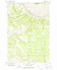
1963 Map of Boles
USGS Topo · Published 1977About this map
Joseph Plains dominates the central landscape of this Idaho interior survey, where the high plateau gives way to the deep carving of the Salmon River canyon. A network of primitive Jeep Trails and Pack Trails provides the primary access across this terrain, connecting isolated settlements like Boles and riverfront points such as White House Bar. The map preserves specific markers of the era's mountain life, from the solitary Mine located south of Home Sweet Home Creek to the memorial at Soldiers Grave near the headwaters of Cottonwood Creek.
Find a feature on this map
32 named features on this map. Tap any name to fly to it.
Don’t see what you’re looking for? This feature index may not catch every label — zoom into the map to look around manually.
Map Details
Editions of this 1963 Boles Map
2 editions found
Other maps of this area

1924 · Kamiah
USGS Topo · 1:125,000

1955 · Pullman
USGS Topo · 1:250,000

1955 · Grangeville
USGS Topo · 1:250,000

1958 · Pullman
USGS Topo · 1:250,000

1959 · Grangeville
USGS Topo · 1:250,000

1963 · Cactus Mtn
USGS Topo · 1:24,000

1963 · Boles
USGS Topo · 1:24,000

1963 · Rattlesnake Ridge
USGS Topo · 1:24,000

1963 · Moughmer Point
USGS Topo · 1:24,000

1963 · Joseph
USGS Topo · 1:24,000