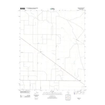
2012 Map of Bolin
USGS Topo · Published 2012About this map
Rita Blanca Cr meanders through the high plains of the Texas Panhandle, anchoring this 2012 survey of Dallam County. The landscape is defined by the organized grid of rural ranching life, centered around the small settlement of Ware and the rail-oriented location of Bolin to the southeast. Transport and access are dictated by a network of named local arteries, including Ranch Road 102, Hoss Carter Ln, and Wharton Ln, which connect the dispersed agricultural operations of this corner of Texas. The map reveals the relationship between the natural drainage of the creek and the human imprint of modern land management, where linear roads like Brorman Rd and Burrow Rd segment the territory into massive, functional blocks characteristic of the region's cattle and grain economy.
Find a feature on this map
13 named features on this map. Tap any name to fly to it.
Don’t see what you’re looking for? This feature index may not catch every label — zoom into the map to look around manually.
Map Details
Editions of this 2012 Bolin Map
This is the sole edition of this map. No revisions or reprints were ever made.
Other maps of this area

1954 · Dalhart
USGS Topo · 1:250,000

1958 · Dalhart
USGS Topo · 1:250,000

1962 · Dalhart
USGS Topo · 1:250,000

1973 · Wharton Ranch
USGS Topo · 1:24,000

1973 · Tovrea Ranch
USGS Topo · 1:24,000

1973 · Perico
USGS Topo · 1:24,000

1973 · Canyon School
USGS Topo · 1:24,000

1973 · Bolin NE
USGS Topo · 1:24,000

1973 · Bolin
USGS Topo · 1:24,000
1973 · Wells Ranch
USGS Topo · 1:24,000