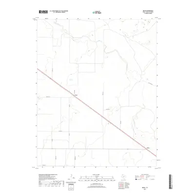
2019 Map of Bolin
USGS Topo · Published 2019About this map
Rita Blanca Cr meanders across this high plains landscape of Dallam County, defining the drainage patterns of an area characterized by vast rangelands and sparse settlements. The diagonal corridor of 87 serves as the primary artery for the region, connecting the small communities of Ware and Bolin. This transport axis dictates the local geography, with secondary roads such as Ranch Rd 102 and Capital Rd branching out to serve various ranches and agricultural holdings.
Find a feature on this map
18 named features on this map. Tap any name to fly to it.
Don’t see what you’re looking for? This feature index may not catch every label — zoom into the map to look around manually.
Map Details
Editions of this 2019 Bolin Map
This is the sole edition of this map. No revisions or reprints were ever made.
Other maps of this area

1954 · Dalhart
USGS Topo · 1:250,000

1958 · Dalhart
USGS Topo · 1:250,000

1962 · Dalhart
USGS Topo · 1:250,000

1973 · Wharton Ranch
USGS Topo · 1:24,000

1973 · Tovrea Ranch
USGS Topo · 1:24,000

1973 · Perico
USGS Topo · 1:24,000

1973 · Canyon School
USGS Topo · 1:24,000

1973 · Bolin NE
USGS Topo · 1:24,000

1973 · Bolin
USGS Topo · 1:24,000
1973 · Wells Ranch
USGS Topo · 1:24,000