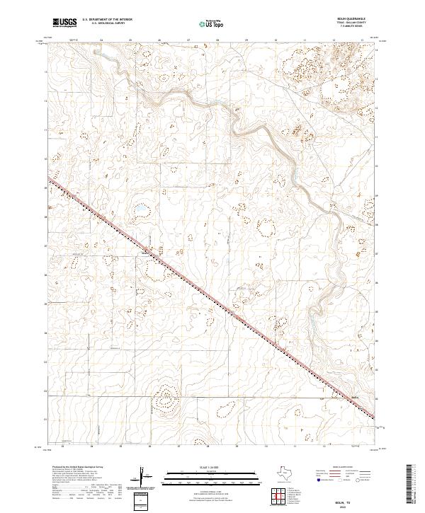
2022 Map of Bolin
USGS Topo · Published 2022About this map
Rita Blanca Cr carves a winding path through this corner of the Texas Panhandle, defining the drainage patterns across a landscape dominated by ranch roads and straight-line boundaries. The primary corridor of activity follows the diagonal route of Highway 87, which connects the small settlements of Ware and Bolin. This transport axis represents the region's historic reliance on road and rail connections for movement across the high plains. Away from the highway, a network of named tracks such as Capital Rd, Pollard Rd, and Brorman Rd suggest the local landholdings and family ranching operations that have shaped Dallam County. The map provides a clear picture of the modern high-plains landscape where traditional grazing lands are accessed by a grid of rural lanes like Spielman Ln and Mustang Ln.
Find a feature on this map
18 named features on this map. Tap any name to fly to it.
Don’t see what you’re looking for? This feature index may not catch every label — zoom into the map to look around manually.
Map Details
Editions of this 2022 Bolin Map
This is the sole edition of this map. No revisions or reprints were ever made.
Other maps of this area

1954 · Dalhart
USGS Topo · 1:250,000

1958 · Dalhart
USGS Topo · 1:250,000

1962 · Dalhart
USGS Topo · 1:250,000

1973 · Wharton Ranch
USGS Topo · 1:24,000

1973 · Tovrea Ranch
USGS Topo · 1:24,000

1973 · Perico
USGS Topo · 1:24,000

1973 · Canyon School
USGS Topo · 1:24,000

1973 · Bolin NE
USGS Topo · 1:24,000

1973 · Bolin
USGS Topo · 1:24,000
1973 · Wells Ranch
USGS Topo · 1:24,000