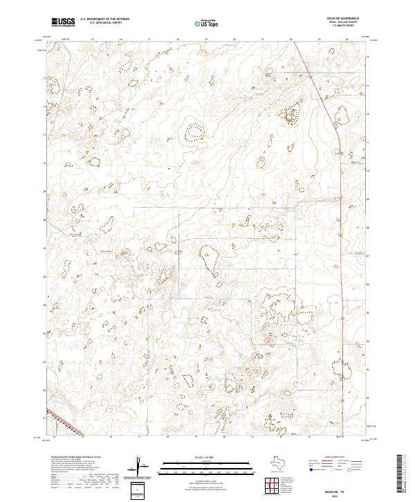
2022 Map of Bolin NE
USGS Topo · Published 2022About this map
Rita Blanca Cr cuts across the southwestern corner of this landscape in the High Plains of the Texas Panhandle. The terrain is characterized by a network of rural roads that reflect the area's agricultural and ranching heritage, featuring family-named routes such as Hoss Carter Rd and Mackey Rd. These corridors connect sparse holdings across the open country, while smaller lanes like Orchard Ln and Beach Ln suggest the localized development of specific properties or homesteads. The map illustrates the contemporary layout of land divisions in Dallam County, where long-established watercourses like the creek remain the primary natural landmarks amidst a grid of modern transit paths including Porter Ln and 5m Ln.
Find a feature on this map
9 named features on this map. Tap any name to fly to it.
Don’t see what you’re looking for? This feature index may not catch every label — zoom into the map to look around manually.
Map Details
Editions of this 2022 Bolin NE Map
This is the sole edition of this map. No revisions or reprints were ever made.
Other maps of this area

1954 · Dalhart
USGS Topo · 1:250,000

1958 · Dalhart
USGS Topo · 1:250,000

1962 · Dalhart
USGS Topo · 1:250,000

1973 · Tovrea Ranch
USGS Topo · 1:24,000

1973 · Canyon School
USGS Topo · 1:24,000

1973 · Bolin NE
USGS Topo · 1:24,000

1973 · Bolin
USGS Topo · 1:24,000
1973 · Pritchard Ranch
USGS Topo · 1:24,000
1973 · Dalhart East
USGS Topo · 1:24,000
1973 · Dalhart West
USGS Topo · 1:24,000