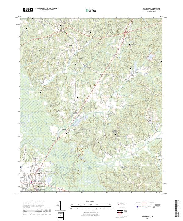
2022 Map of Bolivar East
USGS Topo · Published 2022About this map
The Hatchie River meanders across the landscape, defining the character of the Hatchie Bottom region east of Bolivar. This 2022 survey documents the county seat's core, featuring the Hardeman County Courthouse and Hardeman County Criminal Justice Complex. The terrain is marked by a dense concentration of family and community burial grounds, such as the Bills Family Cem and Parker Hill Cem, which suggest generations of local land ownership. To the north, the settlement of Toone sits along a network of country lanes, while the eastern portion of the map is dominated by wetlands and water bodies like Lake Lajoie and Gibson Pond. The distribution of rural landmarks, including the Hill-Field Baptist Church and Ebenezer Baptist Church Cem - South, illustrates the enduring religious and social anchors of the Hardeman County countryside.
Find a feature on this map
109 named features on this map. Tap any name to fly to it.
Don’t see what you’re looking for? This feature index may not catch every label — zoom into the map to look around manually.
Map Details
Editions of this 2022 Bolivar East Map
This is the sole edition of this map. No revisions or reprints were ever made.
Other maps of this area

1950 · Hebron
USGS Topo · 1:24,000

1950 · Hornsby
USGS Topo · 1:24,000

1950 · Middleburg
USGS Topo · 1:24,000

1951 · Middleburg
USGS Topo · 1:24,000

1951 · Hebron
USGS Topo · 1:24,000

1951 · Hornsby
USGS Topo · 1:24,000

1956 · Blytheville
USGS Topo · 1:250,000

1959 · Blytheville
USGS Topo · 1:250,000

1961 · Bolivar West
USGS Topo · 1:24,000

1961 · Medon
USGS Topo · 1:24,000