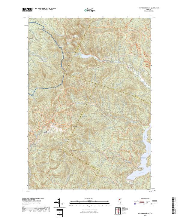
2024 Map of Bolton Mountain
USGS Topo · Published 2024About this map
The Green Mountains define this section of Vermont where the borders of Chittenden, Lamoille, and Washington counties meet. At the heart of the landscape is the high-elevation development at Bolton Valley, surrounded by a dense network of trails such as the Long Trl, Catamount Trl, and Underhill Trl. This area is a significant hub for alpine and Nordic recreation, featuring numerous named runs and paths like Slayton Pasture Trl and Shredder.
Find a feature on this map
90 named features on this map. Tap any name to fly to it.
Don’t see what you’re looking for? This feature index may not catch every label — zoom into the map to look around manually.
Map Details
Editions of this 2024 Bolton Mountain Map
This is the sole edition of this map. No revisions or reprints were ever made.
Other maps of this area

1919 · Montpelier
USGS Topo · 1:62,500

1921 · Richmond
USGS Topo · 1:48,000

1921 · Montpelier
USGS Topo · 1:62,500

1924 · Camels Hump
USGS Topo · 1:62,500

1925 · Mount Mansfield
USGS Topo · 1:48,000

1927 · Mount Mansfield
USGS Topo · 1:62,500

1927 · Hyde Park
USGS Topo · 1:48,000

1930 · Hyde Park
USGS Topo · 1:62,500
1943 · Hyde Park
USGS Topo · 1:62,500

1944 · Montpelier
USGS Topo · 1:62,500