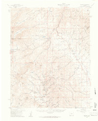
1959 Map of Bonanza
USGS Topo · Published 1961About this map
Mining operations dominate this high-altitude landscape where the San Isabel National Forest, Rio Grande National Forest, and Gunnison National Forest converge. The industrial footprint of the Bonanza Mining District is meticulously documented, featuring a dense network of claims such as the Bonanza Mine, Rawley Mine, and Cocomongo Mine. Traces of the silver and lead boom remain at the Sedgwick townsite and Kerber City, while the Old Railroad Grade leading toward Mears Junction reflects the logistical challenges of transporting ore from the peaks. Beyond the extraction sites, the map details the transition from industrial to agricultural and administrative use, noting the Brewery Creek Guard Station and established homesteads like Blanchard Ranch and Shewalter Ranch. The presence of the Cem and multiple mills like the Little Bonanza Mill provides essential data for researchers tracking the movement of early mining families through the Saguache and Chaffee County borderlands.
Find a feature on this map
127 named features on this map. Tap any name to fly to it.
Don’t see what you’re looking for? This feature index may not catch every label — zoom into the map to look around manually.
Map Details
Editions of this 1959 Bonanza Map
5 editions found
Other maps of this area

1940 · Garfield
USGS Topo · 1:62,500

1945 · Garfield
USGS Topo · 1:62,500

1954 · Pueblo
USGS Topo · 1:250,000

1956 · Cameron Mountain
USGS Topo · 1:62,500

1956 · Poncha Springs
USGS Topo · 1:62,500

1956 · Montrose
USGS Topo · 1:250,000

1957 · Pueblo
USGS Topo · 1:250,000

1958 · Pueblo
USGS Topo · 1:250,000

1959 · Montrose
USGS Topo · 1:250,000

1959 · Bonanza
USGS Topo · 1:62,500