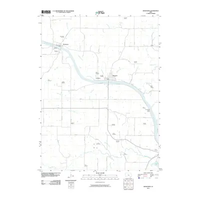
2010 Map of Bonaparte
USGS Topo · Published 2010About this map
The Des Moines River carves a winding path through this corner of Van Buren County, anchoring the historic riverfront communities of Bonaparte, Bentonsport, and Vernon. These settlements reflect an era of river-based commerce and early Iowa development, connected by landmarks like the Bentonsport Bridge. The landscape is densely marked by a network of rural burial grounds, including Holsworth Cemetery, Bradford Cemetery, and Reed's Creek Cemetery, which offer significant value for genealogical research in the region.
Find a feature on this map
71 named features on this map. Tap any name to fly to it.
Don’t see what you’re looking for? This feature index may not catch every label — zoom into the map to look around manually.
Map Details
Editions of this 2010 Bonaparte Map
This is the sole edition of this map. No revisions or reprints were ever made.
Other maps of this area

1958 · Burlington
USGS Topo · 1:250,000

1961 · Burlington
USGS Topo · 1:250,000

1963 · Burlington
USGS Topo · 1:250,000

1968 · Anson
USGS Topo · 1:24,000

1968 · Bonaparte
USGS Topo · 1:24,000
1968 · Croton
USGS Topo · 1:24,000

1968 · Keosauqua
USGS Topo · 1:24,000

1968 · Farmington
USGS Topo · 1:24,000
1968 · Mount Sterling
USGS Topo · 1:24,000
1981 · Mount Zion
USGS Topo · 1:24,000