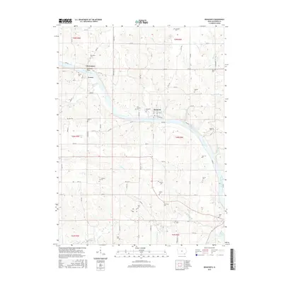
2015 Map of Bonaparte
USGS Topo · Published 2015About this map
The Des Moines River carves a deep valley through this corner of Van Buren County, anchoring a series of riverfront settlements connected by the Bentonsport Bridge. The map details the proximity of Bentonsport and Vernon, situated on opposite banks, alongside the village of Bonaparte downstream. This landscape is a significant corridor for local history, with numerous burial grounds such as New Lexington Cem, Rhodes Cem, and Bradford Cem dotting the bluffs and plateaus above the river.
Find a feature on this map
84 named features on this map. Tap any name to fly to it.
Don’t see what you’re looking for? This feature index may not catch every label — zoom into the map to look around manually.
Map Details
Editions of this 2015 Bonaparte Map
This is the sole edition of this map. No revisions or reprints were ever made.
Other maps of this area

1958 · Burlington
USGS Topo · 1:250,000

1961 · Burlington
USGS Topo · 1:250,000

1963 · Burlington
USGS Topo · 1:250,000

1968 · Anson
USGS Topo · 1:24,000

1968 · Bonaparte
USGS Topo · 1:24,000
1968 · Croton
USGS Topo · 1:24,000

1968 · Keosauqua
USGS Topo · 1:24,000

1968 · Farmington
USGS Topo · 1:24,000
1968 · Mount Sterling
USGS Topo · 1:24,000
1981 · Mount Zion
USGS Topo · 1:24,000