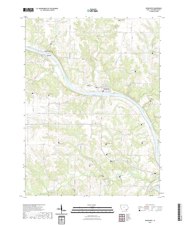
2022 Map of Bonaparte
USGS Topo · Published 2022About this map
The Des Moines River winds through this section of Van Buren County, serving as the historical and geographical anchor for several riverside settlements. Along its banks, the village of Bonaparte sits as a primary hub, while the nearby hamlets of Bentonsport and Vernon reflect the area's early river-and-rail orientation. The landscape is deeply etched by a network of tributaries including Honey Cr, Bear Creek, and Lexington Cr, which have created a complex series of ridges and valleys.
Find a feature on this map
86 named features on this map. Tap any name to fly to it.
Don’t see what you’re looking for? This feature index may not catch every label — zoom into the map to look around manually.
Map Details
Editions of this 2022 Bonaparte Map
This is the sole edition of this map. No revisions or reprints were ever made.
Other maps of this area

1958 · Burlington
USGS Topo · 1:250,000

1961 · Burlington
USGS Topo · 1:250,000

1963 · Burlington
USGS Topo · 1:250,000

1968 · Anson
USGS Topo · 1:24,000

1968 · Bonaparte
USGS Topo · 1:24,000
1968 · Croton
USGS Topo · 1:24,000

1968 · Keosauqua
USGS Topo · 1:24,000

1968 · Farmington
USGS Topo · 1:24,000
1968 · Mount Sterling
USGS Topo · 1:24,000
1981 · Mount Zion
USGS Topo · 1:24,000