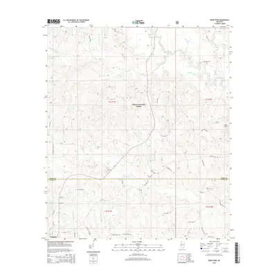
2015 Map of Bond Pond
USGS Topo · Published 2015About this map
The Desoto National Forest dominates this section of the Mississippi piney woods, where a network of family-named roads and remote burial grounds reflects the deep local roots of Stone and Perry Counties. The landscape is defined by the winding course of Black Creek and its many tributaries, including Beaverdam Cr and Bluff Cr, which drain the area toward the Bond Pond and Flint Cr Reservoir near Wiggins. Genealogists can find numerous family landmarks such as the Howard-Breland Cem, Sims Cem, and Taylor Cemetery, often situated near the creeks that dictated early settlement patterns. Industrial activity is represented by an Oil Well near Bridge Cr, while the eastern edge is marked by the Red Hills, providing a clear record of the intersection between timberland conservation and private rural life in the mid-2010s.
Find a feature on this map
63 named features on this map. Tap any name to fly to it.
Don’t see what you’re looking for? This feature index may not catch every label — zoom into the map to look around manually.
Map Details
Editions of this 2015 Bond Pond Map
This is the sole edition of this map. No revisions or reprints were ever made.
Other maps of this area

1947 · Beaumont
USGS Topo · 1:62,500

1947 · Wiggins
USGS Topo · 1:62,500

1947 · New Augusta
USGS Topo · 1:62,500

1947 · Benndale
USGS Topo · 1:62,500

1949 · Wiggins
USGS Topo · 1:62,500

1949 · Beaumont
USGS Topo · 1:62,500

1949 · New Augusta
USGS Topo · 1:62,500

1949 · Benndale
USGS Topo · 1:62,500

1953 · Hattiesburg
USGS Topo · 1:250,000

1953 · Mobile
USGS Topo · 1:250,000