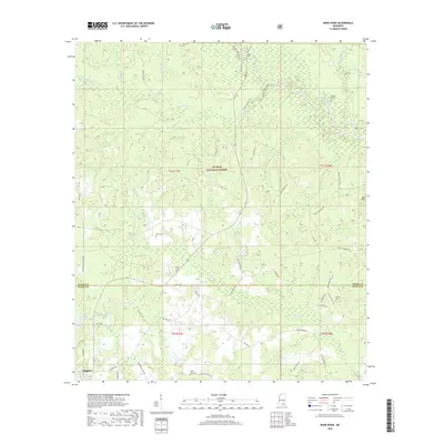
2018 Map of Bond Pond
USGS Topo · Published 2018About this map
De Soto National Forest dominates this landscape in southern Mississippi, where the headwaters of numerous creeks carve through the piney woods. The map centers on the border between Perry and Stone counties, a region defined by its water and family heritage. Wiggins occupies the southwestern corner, anchored by the Flint Cr Reservoir. The density of rural family burial grounds, such as Howard-Breiland Cem, Sims Cem, and Taylor Cem, suggests a long-standing pattern of multi-generational settlement tied to specific land holdings. A network of forest roads and the Black Creek Trail navigate the terrain around Bluff Cr and Bond Pond, while the eastern reaches show the gradual rise toward Red Hills. This survey documents a quiet rural landscape where modern reservoirs and conservation lands coexist with the historic footprint of early Gulf Coast settlers.
Find a feature on this map
59 named features on this map. Tap any name to fly to it.
Don’t see what you’re looking for? This feature index may not catch every label — zoom into the map to look around manually.
Map Details
Editions of this 2018 Bond Pond Map
This is the sole edition of this map. No revisions or reprints were ever made.
Other maps of this area

1947 · Beaumont
USGS Topo · 1:62,500

1947 · Wiggins
USGS Topo · 1:62,500

1947 · New Augusta
USGS Topo · 1:62,500

1947 · Benndale
USGS Topo · 1:62,500

1949 · Wiggins
USGS Topo · 1:62,500

1949 · Beaumont
USGS Topo · 1:62,500

1949 · New Augusta
USGS Topo · 1:62,500

1949 · Benndale
USGS Topo · 1:62,500

1953 · Hattiesburg
USGS Topo · 1:250,000

1953 · Mobile
USGS Topo · 1:250,000