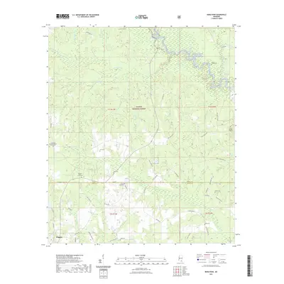
2021 Map of Bond Pond
USGS Topo · Published 2021About this map
De Soto National Forest dominates this section of the Mississippi piney woods, where the Black Creek Wild and Scenic River carves a winding path through the northern landscape. The map reveals a deeply rooted rural community straddling the Perry Co and Stone Co line, evidenced by a high density of family and church burial grounds. Several established sites such as Ebenezer Baptist Church Cem, Haines Family Cem, and Hatten Cem serve as focal points for local history. Transport in this era is defined by a network of forest service and county roads, including Oil Well Rd and Fairley Bridge Rd, alongside the primitive Black Creek Trail. The topography transitions toward the Red Hills in the east, while the southern margin reaches the outskirts of Wiggins.
Find a feature on this map
67 named features on this map. Tap any name to fly to it.
Don’t see what you’re looking for? This feature index may not catch every label — zoom into the map to look around manually.
Map Details
Editions of this 2021 Bond Pond Map
This is the sole edition of this map. No revisions or reprints were ever made.
Other maps of this area

1947 · Beaumont
USGS Topo · 1:62,500

1947 · Wiggins
USGS Topo · 1:62,500

1947 · New Augusta
USGS Topo · 1:62,500

1947 · Benndale
USGS Topo · 1:62,500

1949 · Wiggins
USGS Topo · 1:62,500

1949 · Beaumont
USGS Topo · 1:62,500

1949 · New Augusta
USGS Topo · 1:62,500

1949 · Benndale
USGS Topo · 1:62,500

1953 · Hattiesburg
USGS Topo · 1:250,000

1953 · Mobile
USGS Topo · 1:250,000