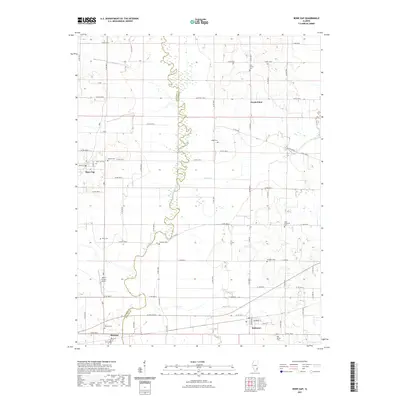
2021 Map of Bone Gap
USGS Topo · Published 2021About this map
Bonpas Creek meanders along the boundary between Edwards and Wabash counties, defining a landscape of agriculture and small settlements in southern Illinois. The village of Bone Gap stands out on the western side of the creek, anchored by the intersection of Main St and Church St, while the community of Bellmont occupies the southern reaches of the quadrangle. This area is particularly rich in family and community burial grounds, preserving local history through sites such as Saint Sebastian Cem, Tanquary Cem, and Old Bethel Cem. The terrain is drained by tributaries like Walser Cr and Fordice Cr, which feed into the larger creek system. Further south, the map details Browns and its namesake Browns Cem, while modern infrastructure is represented by the Nelson Private Airport nestled among the grid of county roads.
Find a feature on this map
70 named features on this map. Tap any name to fly to it.
Don’t see what you’re looking for? This feature index may not catch every label — zoom into the map to look around manually.
Map Details
Editions of this 2021 Bone Gap Map
This is the sole edition of this map. No revisions or reprints were ever made.
Other maps of this area

1903 · Patoka
USGS Topo · 1:125,000

1904 · Mount Carmel
USGS Topo · 1:62,500

1911 · Sumner
USGS Topo · 1:62,500

1913 · Sumner
USGS Topo · 1:62,500

1943 · Albion
USGS Topo · 1:62,500

1946 · Albion
USGS Topo · 1:62,500

1949 · Olney
USGS Topo · 1:62,500

1956 · Vincennes
USGS Topo · 1:250,000

1957 · Vincennes
USGS Topo · 1:250,000

1958 · Vincennes
USGS Topo · 1:250,000