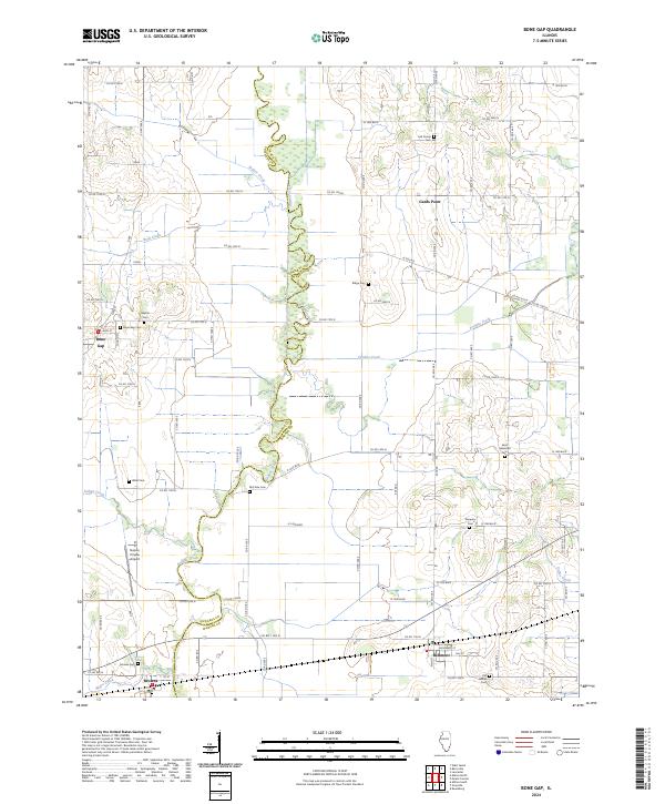
2024 Map of Bone Gap
USGS Topo · Published 2024About this map
Bonpas Creek forms the primary geographic boundary between Edwards and Wabash counties in this Illinois quadrangle. The agricultural landscape is dotted with several small rural communities, including Bone Gap, Bellmont, and Browns. This area is particularly rich in genealogical data, evidenced by a high density of country burial grounds such as Lick Prairie Cem, Old Bethel Cem, and Saint Sebastian Cem. The drainage patterns are defined by numerous tributaries, with Fordice Creek and Coffee Creek carving through the prairie to meet the larger Bonpas Creek basin. Near Browns, the topography is further shaped by Negro Creek as it approaches the county line. The presence of the Nelson Private Airport south of Bone Gap indicates the modern utility of these open fields within this long-established farming region.
Find a feature on this map
77 named features on this map. Tap any name to fly to it.
Don’t see what you’re looking for? This feature index may not catch every label — zoom into the map to look around manually.
Map Details
Editions of this 2024 Bone Gap Map
This is the sole edition of this map. No revisions or reprints were ever made.
Other maps of this area

1903 · Patoka
USGS Topo · 1:125,000

1904 · Mount Carmel
USGS Topo · 1:62,500

1911 · Sumner
USGS Topo · 1:62,500

1913 · Sumner
USGS Topo · 1:62,500

1943 · Albion
USGS Topo · 1:62,500

1946 · Albion
USGS Topo · 1:62,500

1949 · Olney
USGS Topo · 1:62,500

1956 · Vincennes
USGS Topo · 1:250,000

1957 · Vincennes
USGS Topo · 1:250,000

1958 · Vincennes
USGS Topo · 1:250,000