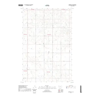
2017 Map of Bonetraill SE
USGS Topo · Published 2017About this map
Saint George Cem and Cow Creek Cem stand as quiet landmarks within this rural Williams County landscape, marking the generational history of the northern high plains. This 2017 survey reveals an area defined by a rigorous grid of section lines and township boundaries, including t156n r102w and t155n r103w, which dictate the placement of local roads like Hebron Township Rd. The terrain is etched by the drainage patterns of Cow Cr in the north and Sand Cr to the south, where the prairie breaks into complex coulees and draws. The infrastructure remains centered on agriculture and transit, with Co Hwy 8 and a network of numeric routes such as 144th Ave NW and 60th St NW providing access to the isolated farmsteads and fields that characterize this portion of North Dakota.
Find a feature on this map
26 named features on this map. Tap any name to fly to it.
Don’t see what you’re looking for? This feature index may not catch every label — zoom into the map to look around manually.
Map Details
Editions of this 2017 Bonetraill SE Map
This is the sole edition of this map. No revisions or reprints were ever made.
Other maps of this area

1953 · Williston
USGS Topo · 1:250,000

1957 · Williston
USGS Topo · 1:250,000

1959 · Williston West
USGS Topo · 1:24,000

1974 · Blacktail Lake
USGS Topo · 1:24,000

1974 · Bonetraill
USGS Topo · 1:24,000

1974 · Otter Tail Creek
USGS Topo · 1:24,000

1974 · West Bonetraill
USGS Topo · 1:24,000

1974 · Bonetraill SW
USGS Topo · 1:24,000

1974 · Trenton NE
USGS Topo · 1:24,000
1974 · Trenton NW
USGS Topo · 1:24,000