
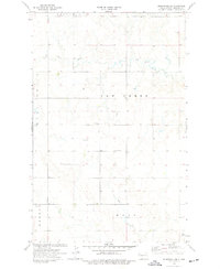
1974 Map of Otter Tail Creek
USGS Topo · Published 1977About this map
Missouri Ridge dominates the southern landscape of this Williams County region, where the high prairie begins its descent toward the drainage basins of the Missouri River. The land is defined by a series of townships including Tyrone, Athens, and Blacktail, reflecting the early 20th-century administrative organization of the North Dakota frontier. Waterways like Otter Tail Creek, Cow Creek, and Camp Creek carve through the undulating terrain, providing the essential drainage for this agricultural and ranching country.
Find a feature on this map
18 named features on this map. Tap any name to fly to it.
Don’t see what you’re looking for? This feature index may not catch every label — zoom into the map to look around manually.
Map Details
Editions of this 1974 Otter Tail Creek Map
This is the sole edition of this map. No revisions or reprints were ever made.
Other maps of this area

1953 · Williston
USGS Topo · 1:250,000

1957 · Williston
USGS Topo · 1:250,000

1959 · Marmon SE
USGS Topo · 1:24,000

1959 · Williston West
USGS Topo · 1:24,000

1959 · Williston East
USGS Topo · 1:24,000

1974 · Blacktail Lake
USGS Topo · 1:24,000

1974 · Bonetraill
USGS Topo · 1:24,000

1974 · Twin Lakes
USGS Topo · 1:24,000

1974 · Trenton NE
USGS Topo · 1:24,000
1974 · Bonetraill SE
USGS Topo · 1:24,000