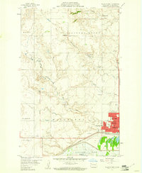
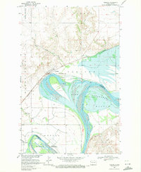
1959 Map of Williston West
USGS Topo · Published 1960About this map
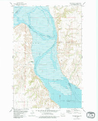
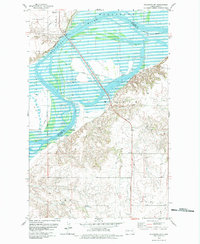
The growing city of Williston dominates the southeastern quadrant of this late-1950s survey, showing a transition from its agrarian roots to a regional hub. Significant infrastructure is evident, from the grid of city streets like 18th St and 14th St to the Sloulin Field airport and the Agricultural Experiment Station to the west. The landscape is defined by the Missouri Ridge and the Missouri River valley, where the rising waters of Garrison Lake are held back by a Levee. Rural education and community life are represented by several named schoolhouses, including Tandy Y-Sch, Township Sch, and Tone Sch. Traces of the region's historical connectivity appear at the Old Military Reservation Boundary, while the Great Northern railroad continues to follow the river course, serving as a vital transport artery for the high plains.
Find a feature on this map
37 named features on this map. Tap any name to fly to it.
Don’t see what you’re looking for? This feature index may not catch every label — zoom into the map to look around manually.
Map Details
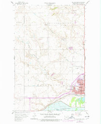
Editions of this 1959 Williston West Map
2 editions found
Other maps of this area

1953 · Williston
USGS Topo · 1:250,000

1957 · Williston
USGS Topo · 1:250,000
1959 · Marmon SE
USGS Topo · 1:24,000
1959 · Williston East
USGS Topo · 1:24,000
1969 · Trenton
USGS Topo · 1:24,000
1974 · Otter Tail Creek
USGS Topo · 1:24,000
1974 · Trenton NE
USGS Topo · 1:24,000
1974 · Bonetraill SE
USGS Topo · 1:24,000
1979 · Williston SE
USGS Topo · 1:24,000
1979 · Williston SW
USGS Topo · 1:24,000