
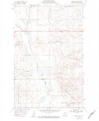
1959 Map of Marmon SE
USGS Topo · Published 1960About this map
Missouri Ridge defines the southwestern portion of this North Dakota landscape, overlooking a complex drainage network where the Little Muddy River meets tributaries like Cow Creek and Otter Tail Creek. This late 1950s survey captures a transition in the rural Williams County infrastructure, documented by the North Dakota Water Conservation Commission under Chairman John E. Davis. The placement of a Gaging Sta and a prominent Levee suggests active water management along the river valley during this era.
Find a feature on this map
15 named features on this map. Tap any name to fly to it.
Don’t see what you’re looking for? This feature index may not catch every label — zoom into the map to look around manually.
Map Details
Editions of this 1959 Marmon SE Map
3 editions found

Other maps of this area

1911 · Ray
USGS Topo · 1:125,000

1953 · Williston
USGS Topo · 1:250,000

1957 · Williston
USGS Topo · 1:250,000

1959 · Williston West
USGS Topo · 1:24,000

1959 · Williston East
USGS Topo · 1:24,000

1974 · Blacktail Lake
USGS Topo · 1:24,000

1974 · Otter Tail Creek
USGS Topo · 1:24,000

1974 · Twin Lakes
USGS Topo · 1:24,000

1978 · Epping NW
USGS Topo · 1:24,000

1978 · Spring Brook
USGS Topo · 1:24,000