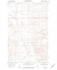
1959 Map of Marmon SE
USGS Topo · Published 1980About this map
The Little Muddy River winds through the heart of this North Dakota landscape, carving a valley between the prominent elevations of Missouri Ridge. Surveyed in the late 1950s, the map documents a rural section of Williams County where the township boundaries of Athens, Dublin, Tyrone, East Fork, and Pherrin converge. The agricultural and educational infrastructure of the period is visible through the placement of rural schoolhouses, including East Fork Sch and Brown Sch.
Find a feature on this map
13 named features on this map. Tap any name to fly to it.
Don’t see what you’re looking for? This feature index may not catch every label — zoom into the map to look around manually.
Map Details
Editions of this 1959 Marmon SE Map
3 editions found

Other maps of this area

1911 · Ray
USGS Topo · 1:125,000

1953 · Williston
USGS Topo · 1:250,000

1957 · Williston
USGS Topo · 1:250,000

1959 · Marmon SE
USGS Topo · 1:24,000

1959 · Williston West
USGS Topo · 1:24,000

1959 · Williston East
USGS Topo · 1:24,000

1974 · Blacktail Lake
USGS Topo · 1:24,000

1974 · Otter Tail Creek
USGS Topo · 1:24,000

1974 · Twin Lakes
USGS Topo · 1:24,000

1978 · Epping NW
USGS Topo · 1:24,000