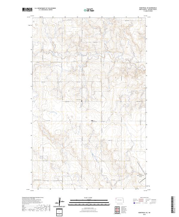
2024 Map of Bonetraill SE
USGS Topo · Published 2024About this map
Saint George Cem and Cow Creek Cem stand as significant genealogical landmarks in this portion of Williams County, marking the burial sites of early homesteaders and families in the rural township. The landscape is defined by the drainage systems of Cow Creek and Sand Creek, which wind through the sectioned agricultural land. The transition toward modern infrastructure is evident in the southeastern corner, where the extensive grounds of the Williston Basin International Airport reflect the area's role as a regional transportation hub. A rigid grid of section-line roads, including Co Hwy 8 and Hebron Township Rd, provides access across the township lines of T156N and T155N, illustrating the systematic land division that has governed the North Dakota prairie since settlement.
Find a feature on this map
27 named features on this map. Tap any name to fly to it.
Don’t see what you’re looking for? This feature index may not catch every label — zoom into the map to look around manually.
Map Details
Editions of this 2024 Bonetraill SE Map
This is the sole edition of this map. No revisions or reprints were ever made.
Other maps of this area

1953 · Williston
USGS Topo · 1:250,000

1957 · Williston
USGS Topo · 1:250,000

1959 · Williston West
USGS Topo · 1:24,000

1974 · Blacktail Lake
USGS Topo · 1:24,000

1974 · Bonetraill
USGS Topo · 1:24,000

1974 · Otter Tail Creek
USGS Topo · 1:24,000

1974 · West Bonetraill
USGS Topo · 1:24,000

1974 · Bonetraill SW
USGS Topo · 1:24,000

1974 · Trenton NE
USGS Topo · 1:24,000
1974 · Trenton NW
USGS Topo · 1:24,000