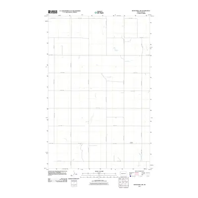
2011 Map of Bonetraill SW
USGS Topo · Published 2011About this map
Cow Creek winds through this rural section of Williams County, defining the drainage of a landscape marked by the precise grid of North Dakota's section lines. The most significant historical marker on this 2011 survey is the Williston Cemetery, located along County Hwy-6 in the southern portion of the quadrangle. This area represents a classic Great Plains agricultural settlement pattern, where long North-South avenues such as 150th Ave NW and 153rd Ave NW intersect with numbered West-East streets, facilitating transport across the vast prairie. In the southeastern corner, the headwaters of Painted Woods Creek emerge, while major arterial routes like County Hwy-8 and County Hwy-5 provide the primary links between isolated farmsteads and larger regional hubs.
Find a feature on this map
22 named features on this map. Tap any name to fly to it.
Don’t see what you’re looking for? This feature index may not catch every label — zoom into the map to look around manually.
Map Details
Editions of this 2011 Bonetraill SW Map
This is the sole edition of this map. No revisions or reprints were ever made.
Other maps of this area

1953 · Williston
USGS Topo · 1:250,000

1954 · Wolf Point
USGS Topo · 1:250,000

1957 · Williston
USGS Topo · 1:250,000

1958 · Wolf Point
USGS Topo · 1:250,000

1974 · Bonetraill
USGS Topo · 1:24,000

1974 · Brush Mountain
USGS Topo · 1:24,000

1974 · West Bonetraill
USGS Topo · 1:24,000

1974 · Red Bank Creek
USGS Topo · 1:24,000

1974 · Bonetraill SW
USGS Topo · 1:24,000

1974 · Trenton NE
USGS Topo · 1:24,000