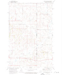
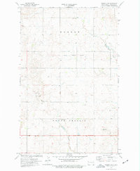
1974 Map of Red Bank Creek
USGS Topo · Published 1977About this map
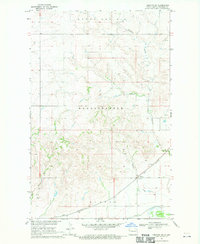
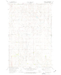
Old Military Reservation Boundary cuts across the northern reaches of this mid-1970s survey, marking a historical division in the landscape between the Hebron and Round Prairie regions. The terrain is defined by the drainage systems of Red Bank Creek, Little Muddy Creek, and Flume Creek, which weave through the borderlands of Williams and Roosevelt Counties. Small-scale industrial activity is evident through scattered Gravel Pits and Scoria Pits, while a modern Rest Area suggests the evolution of travel across this prairie environment. The map captures a moment when the rural landscape maintained its open character, preserved between the intersection of two state lines and the legacy of earlier military land use.
Find a feature on this map
16 named features on this map. Tap any name to fly to it.
Don’t see what you’re looking for? This feature index may not catch every label — zoom into the map to look around manually.
Map Details
Editions of this 1974 Red Bank Creek Map
2 editions found

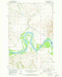
Other maps of this area

1953 · Williston
USGS Topo · 1:250,000

1954 · Wolf Point
USGS Topo · 1:250,000

1957 · Williston
USGS Topo · 1:250,000

1958 · Wolf Point
USGS Topo · 1:250,000
1968 · Trenton SW
USGS Topo · 1:24,000

1968 · Bainville SE
USGS Topo · 1:24,000
1969 · Bainville SW
USGS Topo · 1:24,000
1974 · Bonetraill SW
USGS Topo · 1:24,000
1974 · Trenton NW
USGS Topo · 1:24,000
1974 · Bull Butte
USGS Topo · 1:24,000