
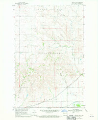
1974 Map of Red Bank Creek
USGS Topo · Published 1989About this map
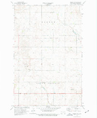
Hebron and Round Prairie define this borderland where the high plains of Northeast Montana meet the North Dakota state line. This 1974 survey, with purple revisions from 1989, captures a landscape of resource extraction and transit infrastructure. Evidence of local industry is clear through various Gravel Pits and Scoria Pits scattered across the township lines, while a major Pipeline and several Tanks cross the terrain. The drainage of Red Bank Creek and Little Muddy Creek dictates the local topography, which includes a Flume and scattered agricultural indicators like Grain Bins. A highway Rest Area situated near the county and state boundaries suggests the area's role as a waypoint for travelers between Roosevelt County, Montana, and Williams County, North Dakota.
Find a feature on this map
13 named features on this map. Tap any name to fly to it.
Don’t see what you’re looking for? This feature index may not catch every label — zoom into the map to look around manually.
Map Details
Editions of this 1974 Red Bank Creek Map
2 editions found
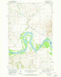
Other maps of this area

1953 · Williston
USGS Topo · 1:250,000

1954 · Wolf Point
USGS Topo · 1:250,000

1957 · Williston
USGS Topo · 1:250,000

1958 · Wolf Point
USGS Topo · 1:250,000
1968 · Trenton SW
USGS Topo · 1:24,000

1968 · Bainville SE
USGS Topo · 1:24,000
1969 · Bainville SW
USGS Topo · 1:24,000
1974 · Red Bank Creek
USGS Topo · 1:24,000
1974 · Bonetraill SW
USGS Topo · 1:24,000
1974 · Trenton NW
USGS Topo · 1:24,000