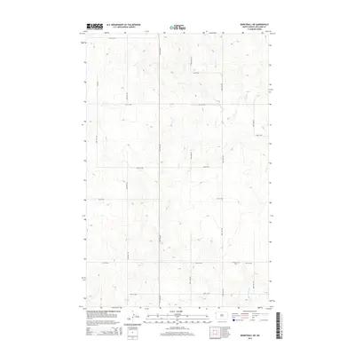
2014 Map of Bonetraill SW
USGS Topo · Published 2014About this map
Williston Cem sits along 59th St NW in this section of Williams County, marking a permanent point of local heritage in a largely agricultural landscape. The terrain is defined by the drainage patterns of Cow Cr, which winds through the central portion of the quadrangle, and Painted Woods Cr in the southeast. This 2014 survey captures the township's established grid system of section roads, including 151st Ave NW and 64th St NW, which facilitate access across the undulating prairie. The lack of concentrated settlements reflects the region's enduring reliance on large-scale ranching and farming, with the only named non-natural feature being the cemetery, a critical site for genealogists and local historians tracing the families who settled this part of North Dakota.
Find a feature on this map
17 named features on this map. Tap any name to fly to it.
Don’t see what you’re looking for? This feature index may not catch every label — zoom into the map to look around manually.
Map Details
Editions of this 2014 Bonetraill SW Map
This is the sole edition of this map. No revisions or reprints were ever made.
Other maps of this area

1953 · Williston
USGS Topo · 1:250,000

1954 · Wolf Point
USGS Topo · 1:250,000

1957 · Williston
USGS Topo · 1:250,000

1958 · Wolf Point
USGS Topo · 1:250,000

1974 · Bonetraill
USGS Topo · 1:24,000

1974 · Brush Mountain
USGS Topo · 1:24,000

1974 · West Bonetraill
USGS Topo · 1:24,000

1974 · Red Bank Creek
USGS Topo · 1:24,000

1974 · Bonetraill SW
USGS Topo · 1:24,000

1974 · Trenton NE
USGS Topo · 1:24,000