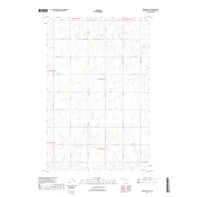
2017 Map of Bonetraill SW
USGS Topo · Published 2017About this map
The rolling plains of northwestern Williams County are defined here by a sparse network of section-line roads and the winding path of Cow Cr. This prairie landscape in the late twenty-teens remains primarily agricultural, organized by the township and range survey system. The southern portion of the sheet is marked by the presence of the Williston Cem, situated near the intersection of 59th St NW and 148th Ave NW. Drainage patterns are shaped by ephemeral watercourses like Painted Woods Cr in the southeast, while the rectilinear road grid, including Hebron Township Rd and various numbered avenues, provides the primary infrastructure for the region. The map captures the quiet character of the North Dakota countryside, where vast open spaces are punctuated by occasional farmsteads and isolated landmarks.
Find a feature on this map
27 named features on this map. Tap any name to fly to it.
Don’t see what you’re looking for? This feature index may not catch every label — zoom into the map to look around manually.
Map Details
Editions of this 2017 Bonetraill SW Map
This is the sole edition of this map. No revisions or reprints were ever made.
Other maps of this area

1953 · Williston
USGS Topo · 1:250,000

1954 · Wolf Point
USGS Topo · 1:250,000

1957 · Williston
USGS Topo · 1:250,000

1958 · Wolf Point
USGS Topo · 1:250,000

1974 · Bonetraill
USGS Topo · 1:24,000

1974 · Brush Mountain
USGS Topo · 1:24,000

1974 · West Bonetraill
USGS Topo · 1:24,000

1974 · Red Bank Creek
USGS Topo · 1:24,000

1974 · Bonetraill SW
USGS Topo · 1:24,000

1974 · Trenton NE
USGS Topo · 1:24,000