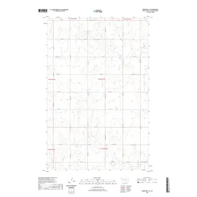
2020 Map of Bonetraill SW
USGS Topo · Published 2020About this map
The rolling plains of northwestern North Dakota are defined by a sparse but deliberate network of section roads and drainage creeks in this 2020 record. Centered in the rural expanse of Williams County, the landscape is punctuated by vital local landmarks like Saint Lucas Cem near the southern boundary and Williston Cem further east. These sites, along with a grid of township roads including Hebron Township Rd, reflect the enduring settlement patterns of the region's agricultural history. The intermittent flow of Cow Cr and Painted Woods Cr cuts through the high country, providing the primary topographic relief in an area otherwise dominated by the vast, open intervals between county highways such as Co Hwy 8 and Co Hwy 6.
Find a feature on this map
22 named features on this map. Tap any name to fly to it.
Don’t see what you’re looking for? This feature index may not catch every label — zoom into the map to look around manually.
Map Details
Editions of this 2020 Bonetraill SW Map
This is the sole edition of this map. No revisions or reprints were ever made.
Other maps of this area

1953 · Williston
USGS Topo · 1:250,000

1954 · Wolf Point
USGS Topo · 1:250,000

1957 · Williston
USGS Topo · 1:250,000

1958 · Wolf Point
USGS Topo · 1:250,000

1974 · Bonetraill
USGS Topo · 1:24,000

1974 · Brush Mountain
USGS Topo · 1:24,000

1974 · West Bonetraill
USGS Topo · 1:24,000

1974 · Red Bank Creek
USGS Topo · 1:24,000

1974 · Bonetraill SW
USGS Topo · 1:24,000

1974 · Trenton NE
USGS Topo · 1:24,000