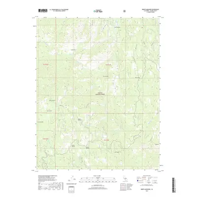
2018 Map of Bonita Meadows
USGS Topo · Published 2018About this map
Sequoia National Forest encompasses this high-elevation landscape in the southern Sierra Nevada, where a network of meadows and seasonal creeks defines the local geography. Significant openings in the forest canopy include Beach Meadows to the north and the expansive Bonita Meadows further south. These meadows, along with family-named or descriptive sites like Curtiss Meadow, Danner Meadow, and Paloma Meadows, indicate a history of summer grazing and resource management within the national forest system.
Find a feature on this map
33 named features on this map. Tap any name to fly to it.
Don’t see what you’re looking for? This feature index may not catch every label — zoom into the map to look around manually.
Map Details
Editions of this 2018 Bonita Meadows Map
This is the sole edition of this map. No revisions or reprints were ever made.
Other maps of this area

1905 · Olancha
USGS Topo · 1:125,000

1905 · Fairview
USGS Topo · 1:24,000

1906 · Kernville
USGS Topo · 1:125,000

1907 · Olancha
USGS Topo · 1:125,000

1908 · Kernville
USGS Topo · 1:125,000

1918 · Fairview
USGS Topo · 1:31,680

1948 · Bakersfield
USGS Topo · 1:250,000

1948 · Fresno
USGS Topo · 1:250,000

1955 · Bakersfield
USGS Topo · 1:250,000

1955 · Fresno
USGS Topo · 1:250,000