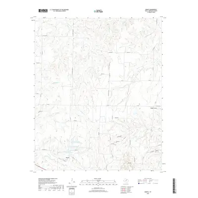
2019 Map of Bonita
USGS Topo · Published 2019About this map
Bonita and the crossroads of Capps Corner define this pocket of North Texas, where the landscape is carved by the drainages of Cottonwood Cr and Farmers Cr. The 2019 survey documents a rural environment maintained by local infrastructure, including a network of farm-to-market roads like FM 1956 and FM 677. Genealogists will find several key burial grounds including Union Cem, Redbud Cem, and Reed Cem, situated near the small settlement of Mt View.
Find a feature on this map
57 named features on this map. Tap any name to fly to it.
Don’t see what you’re looking for? This feature index may not catch every label — zoom into the map to look around manually.
Map Details
Editions of this 2019 Bonita Map
This is the sole edition of this map. No revisions or reprints were ever made.
Other maps of this area

1902 · Gainesville
USGS Topo · 1:125,000

1905 · Montague
USGS Topo · 1:125,000

1943 · Gainesville
USGS Topo · 1:125,000

1954 · Sherman
USGS Topo · 1:250,000

1958 · Sherman
USGS Topo · 1:250,000

1961 · Muenster West
USGS Topo · 1:24,000

1961 · Saint Jo
USGS Topo · 1:24,000

1961 · Montague
USGS Topo · 1:24,000
1968 · Bonita
USGS Topo · 1:24,000
1968 · Spanish Fort
USGS Topo · 1:24,000