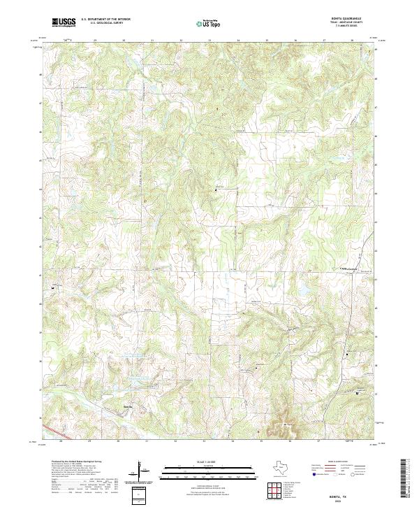
2022 Map of Bonita
USGS Topo · Published 2022About this map
Bonita serves as the focal point for this rural Montague County landscape, where the headwaters of numerous creeks diverge across a network of country roads. The area is defined by its small-scale water management and local heritage sites, notably the series of structures such as Soil Conservation Service Debris Basin 102 and Soil Conservation Service Debris Basin 104 north of the settlement. These basins imply a landscape historically shaped by erosion control and agricultural preservation.
Find a feature on this map
56 named features on this map. Tap any name to fly to it.
Don’t see what you’re looking for? This feature index may not catch every label — zoom into the map to look around manually.
Map Details
Editions of this 2022 Bonita Map
This is the sole edition of this map. No revisions or reprints were ever made.
Other maps of this area

1902 · Gainesville
USGS Topo · 1:125,000

1905 · Montague
USGS Topo · 1:125,000

1943 · Gainesville
USGS Topo · 1:125,000

1954 · Sherman
USGS Topo · 1:250,000

1958 · Sherman
USGS Topo · 1:250,000

1961 · Muenster West
USGS Topo · 1:24,000

1961 · Saint Jo
USGS Topo · 1:24,000

1961 · Montague
USGS Topo · 1:24,000
1968 · Bonita
USGS Topo · 1:24,000
1968 · Spanish Fort
USGS Topo · 1:24,000