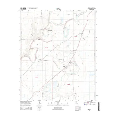
2015 Map of Bonita
USGS Topo · Published 2015About this map
Bonita serves as the central hub of this northeast Louisiana landscape, where the winding course of Bayou Bartholomew dictates the placement of historically significant river access points. The presence of Haynes Landing, Oak Landing, and New Landgrove Landing reflects a legacy of river-based commerce and transportation along the bayou's complex oxbows. These landings, along with the settlement at Jones, indicate a long-standing pattern of settlement tied to the fertile, low-lying ground between major waterways.
Find a feature on this map
66 named features on this map. Tap any name to fly to it.
Don’t see what you’re looking for? This feature index may not catch every label — zoom into the map to look around manually.
Map Details
Editions of this 2015 Bonita Map
This is the sole edition of this map. No revisions or reprints were ever made.
Other maps of this area

1935 · Wilmot
USGS Topo · 1:62,500

1935 · Naff
USGS Topo · 1:62,500

1935 · Bonita
USGS Topo · 1:62,500

1953 · Greenwood
USGS Topo · 1:250,000

1955 · Jackson
USGS Topo · 1:250,000

1956 · Greenwood
USGS Topo · 1:250,000

1956 · Bastrop
USGS Topo · 1:62,500

1958 · Bonita
USGS Topo · 1:62,500

1960 · Wilmot
USGS Topo · 1:62,500
1960 · Wilmot
USGS Topo · 1:24,000