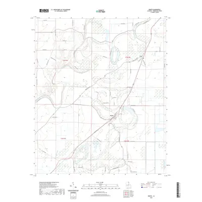
2020 Map of Bonita
USGS Topo · Published 2020About this map
Bayou Bartholomew winds through this corner of Morehouse Parish, defining a landscape of complex waterways and rural crossroads. The village of Bonita serves as a central point, situated near the confluence of local transit routes like Wilmot Rd and Bonita Ave. To the north, the community of Jones is positioned among the wetlands and agricultural fields that characterize the region. The drainage patterns of Bayou Bonne Idee and Bayou Galion illustrate the low-lying topography typical of the Louisiana delta country.
Find a feature on this map
64 named features on this map. Tap any name to fly to it.
Don’t see what you’re looking for? This feature index may not catch every label — zoom into the map to look around manually.
Map Details
Editions of this 2020 Bonita Map
This is the sole edition of this map. No revisions or reprints were ever made.
Other maps of this area

1935 · Wilmot
USGS Topo · 1:62,500

1935 · Naff
USGS Topo · 1:62,500

1935 · Bonita
USGS Topo · 1:62,500

1953 · Greenwood
USGS Topo · 1:250,000

1955 · Jackson
USGS Topo · 1:250,000

1956 · Greenwood
USGS Topo · 1:250,000

1956 · Bastrop
USGS Topo · 1:62,500

1958 · Bonita
USGS Topo · 1:62,500

1960 · Wilmot
USGS Topo · 1:62,500
1960 · Wilmot
USGS Topo · 1:24,000