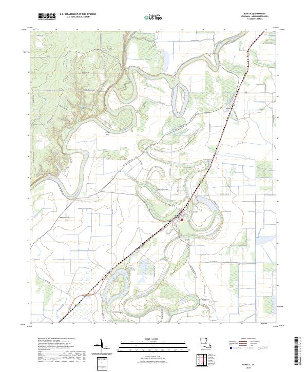
2024 Map of Bonita
USGS Topo · Published 2024About this map
Bonita and the nearby settlement of Jones anchor this portion of Morehouse Parish, where the winding course of Bayou Bartholomew dictates the shape of the land. The landscape is defined by the complex hydrology of the delta, including the oxbow-heavy Bayou Bonne Idee and Overflow Creek. The presence of the Farm Service Agency Interest of Louisiana reflects the region's long-standing agricultural focus, while the persistent labels for Loverett Ferry and numerous named trails like Chitlin Trl and Boney Trl suggest a deeply rooted network of local transit and land use. The map illustrates the characteristic transition between the lower bottomlands and the surrounding timbered terrain, typical of the Louisiana-Arkansas borderlands.
Find a feature on this map
65 named features on this map. Tap any name to fly to it.
Don’t see what you’re looking for? This feature index may not catch every label — zoom into the map to look around manually.
Map Details
Editions of this 2024 Bonita Map
This is the sole edition of this map. No revisions or reprints were ever made.
Other maps of this area

1935 · Wilmot
USGS Topo · 1:62,500

1935 · Naff
USGS Topo · 1:62,500

1935 · Bonita
USGS Topo · 1:62,500

1953 · Greenwood
USGS Topo · 1:250,000

1955 · Jackson
USGS Topo · 1:250,000

1956 · Greenwood
USGS Topo · 1:250,000

1956 · Bastrop
USGS Topo · 1:62,500

1958 · Bonita
USGS Topo · 1:62,500

1960 · Wilmot
USGS Topo · 1:62,500
1960 · Wilmot
USGS Topo · 1:24,000