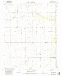
1963 Map of Bonita Ranch
USGS Topo · Published 1983About this map
Bonita Ranch and the surrounding Madera County agricultural landscape are defined by a meticulous grid of water management and orchard development. The Fresno River and Dry Creek meander through the northern sections, while human-engineered infrastructure like the Gravelly Ford Canal and Airport Ditch sustain the valley floor. This mid-century survey reveals a transition from natural watercourses to an intensive irrigation network, evident in the numerous unnamed wells and irrigation channels that dot the property lines. Local life is centered on family-named nodes such as El Peco Ranch and the small settlement of Bonita, supported by community landmarks including Howard Sch and New Hope Hope Cem. To the south, Cottonwood Creek marks the boundary of this productive agricultural zone, where a private Landing Strip and various storage bins indicate the commercial scale of the era's ranching operations.
Find a feature on this map
30 named features on this map. Tap any name to fly to it.
Don’t see what you’re looking for? This feature index may not catch every label — zoom into the map to look around manually.
Map Details
Editions of this 1963 Bonita Ranch Map
4 editions found
Other maps of this area

1916 · Berenda
USGS Topo · 1:31,680

1918 · Chowchilla
USGS Topo · 1:31,680

1918 · Berenda
USGS Topo · 1:31,680

1920 · Kismet
USGS Topo · 1:31,680

1920 · Bonita Ranch
USGS Topo · 1:31,680

1921 · Mendota
USGS Topo · 1:31,680

1921 · Bonita Ranch
USGS Topo · 1:31,680

1922 · Kentucky Well
USGS Topo · 1:31,680

1922 · Madera
USGS Topo · 1:31,680

1923 · Biola
USGS Topo · 1:31,680