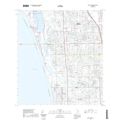
2021 Map of Bonita Springs
USGS Topo · Published 2021About this map
Bonita Springs and its surrounding coastal communities are defined by a complex network of barrier islands and tidal waterways where the Imperial River and Cocohatchee River meet the Gulf of Mexico. The landscape is a dense arrangement of residential developments and preservation areas, stretching from Council down through Naples Park and Pelican Marsh. This survey documents a contemporary era of South Florida coastal living, featuring numerous spiritual landmarks such as the First Presbyterian Church Columbarium Cem and the Saint Leo the Great Catholic Church Cem. These sites, along with the Bonita Springs Cem, provide essential touchstones for local genealogists and historians. For those interested in the natural and recreational character of the region, the map traces the Florida Circumnavigational Paddling Trl as it winds past Big Hickory Island and Wiggins Island, highlighting the region's enduring connection to the water.
Find a feature on this map
40 named features on this map. Tap any name to fly to it.
Don’t see what you’re looking for? This feature index may not catch every label — zoom into the map to look around manually.
Map Details
Editions of this 2021 Bonita Springs Map
This is the sole edition of this map. No revisions or reprints were ever made.
Other maps of this area

1956 · West Palm Beach
USGS Topo · 1:250,000

1957 · West Palm Beach
USGS Topo · 1:250,000

1958 · West Palm Beach
USGS Topo · 1:250,000

1958 · Bonita Springs
USGS Topo · 1:24,000

1958 · Corkscrew NW
USGS Topo · 1:24,000

1958 · Estero
USGS Topo · 1:24,000

1958 · Belle Meade NW
USGS Topo · 1:24,000

1958 · Corkscrew SW
USGS Topo · 1:24,000
1958 · Fort Myers Beach
USGS Topo · 1:24,000

1958 · Naples North
USGS Topo · 1:24,000