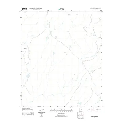
2011 Map of Bonito Prairie
USGS Topo · Published 2011About this map
P Six Ranch and the open expanse of Bonito Prairie define this high-country landscape in eastern Arizona. The terrain is characterized by an extensive system of drainages, including Nash Creek, Turkey Creek, and Corn Creek, which feed into the larger Big Bonito Creek at the southern edge of the sheet. Given the arid nature of the region, the map is heavily marked by vital water infrastructure, ranging from natural sources like Norman Spring and Chino Spring to numerous man-made livestock catchments such as Mule Pasture Tank and Tin Shack Tank. Transportation across the prairie relies on a network of tribal and county roads, including Indian Rte 701 and Co Hwy 72, which connect the remote ranching operations. The naming conventions for local features, such as Navato Pit Tank and County Line Tank, reflect the area's history of land management and rural ranching heritage.
Find a feature on this map
36 named features on this map. Tap any name to fly to it.
Don’t see what you’re looking for? This feature index may not catch every label — zoom into the map to look around manually.
Map Details
Editions of this 2011 Bonito Prairie Map
This is the sole edition of this map. No revisions or reprints were ever made.
Other maps of this area

1954 · Clifton
USGS Topo · 1:250,000

1954 · Mesa
USGS Topo · 1:250,000

1957 · Mesa
USGS Topo · 1:250,000

1957 · Clifton
USGS Topo · 1:250,000

1958 · Clifton
USGS Topo · 1:250,000

1958 · Mesa
USGS Topo · 1:250,000

1960 · Mesa
USGS Topo · 1:250,000

1962 · Clifton
USGS Topo · 1:250,000

1964 · Mesa
USGS Topo · 1:250,000

1966 · Georges Butte
USGS Topo · 1:24,000