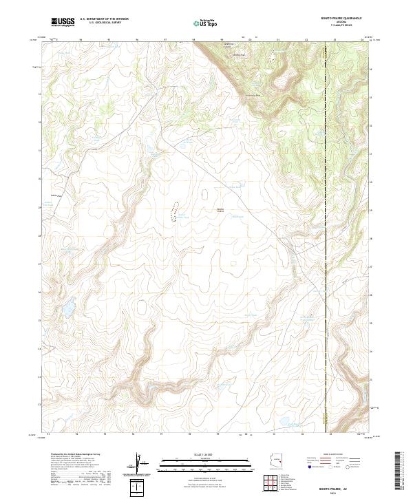
2021 Map of Bonito Prairie
USGS Topo · Published 2021About this map
Bonito Prairie dominates this high-altitude landscape in eastern Arizona, where a complex network of ephemeral drainages and stock tanks reveals the area's history of ranching and water management. The terrain is defined by the dramatic Sevenmile Rim and Sevenmile Canyon in the north, giving way to the broad flats of Indian Flat. This survey highlights the critical importance of water sources in this environment, featuring named springs such as Norman Spring, Sevenmile Spring, and Chino Spring. The presence of numerous specialized catchments like Catfish Tank, Pussy Tank, and Tin Shack Tank underscores the utility of the land for livestock, while the county line between Navajo and Apache Counties cuts vertically through the eastern portion of the sheet.
Find a feature on this map
45 named features on this map. Tap any name to fly to it.
Don’t see what you’re looking for? This feature index may not catch every label — zoom into the map to look around manually.
Map Details
Editions of this 2021 Bonito Prairie Map
This is the sole edition of this map. No revisions or reprints were ever made.
Other maps of this area

1954 · Clifton
USGS Topo · 1:250,000

1954 · Mesa
USGS Topo · 1:250,000

1957 · Mesa
USGS Topo · 1:250,000

1957 · Clifton
USGS Topo · 1:250,000

1958 · Clifton
USGS Topo · 1:250,000

1958 · Mesa
USGS Topo · 1:250,000

1960 · Mesa
USGS Topo · 1:250,000

1962 · Clifton
USGS Topo · 1:250,000

1964 · Mesa
USGS Topo · 1:250,000

1966 · Georges Butte
USGS Topo · 1:24,000