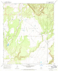
1967 Map of Bonito Prairie
USGS Topo · Published 1971About this map
Bonito Prairie dominates this section of the Fort Apache Indian Reservation, characterized by a remote landscape where water management was essential for livestock and land use. The presence of the Chino Spring Stockman Station near Chino Spring highlights the area's history of cattle ranching and range management during the late 1960s. A network of man-made water features, including the Nash Creek Reservoir and numerous tanks like Tin Shack Tank and Lone Pine Tank, illustrates the effort to sustain life across the high plains and canyons.
Find a feature on this map
29 named features on this map. Tap any name to fly to it.
Don’t see what you’re looking for? This feature index may not catch every label — zoom into the map to look around manually.
Map Details
Editions of this 1967 Bonito Prairie Map
This is the sole edition of this map. No revisions or reprints were ever made.
Other maps of this area

1954 · Clifton
USGS Topo · 1:250,000

1954 · Mesa
USGS Topo · 1:250,000

1957 · Mesa
USGS Topo · 1:250,000

1957 · Clifton
USGS Topo · 1:250,000

1958 · Clifton
USGS Topo · 1:250,000

1958 · Mesa
USGS Topo · 1:250,000

1960 · Mesa
USGS Topo · 1:250,000

1962 · Clifton
USGS Topo · 1:250,000

1964 · Mesa
USGS Topo · 1:250,000

1966 · Georges Butte
USGS Topo · 1:24,000