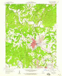
1958 Map of Bonne Terre
USGS Topo · Published 1959About this map
The industrial and civic core of the Lead Belt is anchored by Bonne Terre in the late 1950s, showing a landscape defined by the extraction economy. Numerous large Mine Dump sites are concentrated around the population centers, while the Missouri Illinois RR winds through the hills to serve these operations. The town center is densely mapped, featuring the City Hall, Hospital, and City Park, illustrating a robust local infrastructure supported by mining interests. Outside the main settlement, the land transitions to a network of rural schools and family cemeteries. To the south, Desloge and Cantwell appear near the banks of the Big River, where institutions like the Lead Belt Tech Sch and St Francois Cemetery reflect the long-term community development of the St. Francois County area.
Find a feature on this map
43 named features on this map. Tap any name to fly to it.
Don’t see what you’re looking for? This feature index may not catch every label — zoom into the map to look around manually.
Map Details
Editions of this 1958 Bonne Terre Map
4 editions found
Other maps of this area

1901 · De Soto
USGS Topo · 1:125,000

1904 · Farmington
USGS Topo · 1:62,500

1905 · Bonneterre
USGS Topo · 1:62,500

1906 · Farmington
USGS Topo · 1:62,500

1915 · Crystal City
USGS Topo · 1:62,500

1931 · De Soto SE
USGS Topo · 1:24,000

1937 · Tiff
USGS Topo · 1:24,000

1939 · Tiff
USGS Topo · 1:24,000

1949 · Saint Louis
USGS Topo · 1:250,000

1949 · Rolla
USGS Topo · 1:250,000