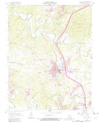
1958 Map of Bonne Terre
USGS Topo · Published 1982About this map
Bonne Terre sits as the central hub of this mid-century Missouri landscape, where the legacy of lead mining is etched into the terrain. Extensive mine dumps and tailings flank the settlement, signaling the industrial intensity of the era. The Missouri Pacific railroad winds through the valley of the Big River, connecting the main town to outlying areas like East Bonne Terre, Hoffman Junction, and the developing residential area of Terre Du Lac.
Find a feature on this map
49 named features on this map. Tap any name to fly to it.
Don’t see what you’re looking for? This feature index may not catch every label — zoom into the map to look around manually.
Map Details
Editions of this 1958 Bonne Terre Map
4 editions found
Other maps of this area

1901 · De Soto
USGS Topo · 1:125,000

1904 · Farmington
USGS Topo · 1:62,500

1905 · Bonneterre
USGS Topo · 1:62,500

1906 · Farmington
USGS Topo · 1:62,500

1915 · Crystal City
USGS Topo · 1:62,500

1931 · De Soto SE
USGS Topo · 1:24,000

1937 · Tiff
USGS Topo · 1:24,000

1939 · Tiff
USGS Topo · 1:24,000

1949 · Saint Louis
USGS Topo · 1:250,000

1949 · Rolla
USGS Topo · 1:250,000