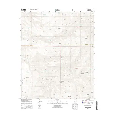
2013 Map of Bonner Canyon
USGS Topo · Published 2013About this map
The Continental Divide winds through this high-altitude landscape of the Gila National Forest, defining a drainage system that feeds the Mimbres River and various ephemeral creeks. This area at the Sierra and Grant County line is characterized by its complex network of canyons and water-management features, including Alligator Tank, Meason Tank, and Polecat Tank. The naming conventions here, such as Tom Moore Canyon, Hodge Canyon, and Me Own Hill, suggest a history of individual land use and prospecting common in the Southwestern frontier. Evidence of range management and early travel is found at Aspen Corral and along N Star Rd, providing a look at the infrastructure required for high-country ranching and forest navigation. From the depths of the Black Canyon Box to the summit of Aspen Mountain, the terrain reflects a period of modern forest administration and land preservation.
Find a feature on this map
34 named features on this map. Tap any name to fly to it.
Don’t see what you’re looking for? This feature index may not catch every label — zoom into the map to look around manually.
Map Details
Editions of this 2013 Bonner Canyon Map
This is the sole edition of this map. No revisions or reprints were ever made.
Other maps of this area

1911 · Alum Mountain
USGS Topo · 1:125,000

1913 · Alum Mountain
USGS Topo · 1:125,000

1949 · Lookout Mountain
USGS Topo · 1:62,500

1954 · Tularosa
USGS Topo · 1:250,000

1954 · Clifton
USGS Topo · 1:250,000

1957 · Clifton
USGS Topo · 1:250,000

1958 · Clifton
USGS Topo · 1:250,000

1958 · Tularosa
USGS Topo · 1:250,000

1962 · Clifton
USGS Topo · 1:250,000

1963 · Bonner Canyon
USGS Topo · 1:24,000