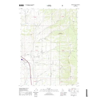
2020 Map of Bonneville Peak
USGS Topo · Published 2020About this map
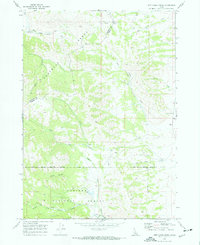
Inkom sits at the intersection of mountain ranges and river valleys, serving as a gateway between the Pocatello Range and the Portneuf Range. The geography is defined by the Portneuf River and Rapid Creek, which carve through the high-elevation terrain of the Caribou National Forest. Residential growth is evident near the town center along North Inkom Road and North Old Highway 91, while the surrounding slopes are marked by complex drainage systems like Webb Creek and Inman Creek. Higher elevations are anchored by prominent summits, including Bonneville Peak and Snow Peak, which overlook historical transit corridors like Inkom Pass. The presence of the Inkom Cemetery and Skyline Airport provides a contrast between the community's established local history and its modern infrastructure, all set against a backdrop of deep canyons and seasonal mountain streams.
Find a feature on this map
73 named features on this map. Tap any name to fly to it.
Don’t see what you’re looking for? This feature index may not catch every label — zoom into the map to look around manually.
Map Details
Editions of this 2020 Bonneville Peak Map
This is the sole edition of this map. No revisions or reprints were ever made.
Other maps of this area

1937 · Pocatello
USGS Topo · 1:48,000

1944 · Pocatello
USGS Topo · 1:62,500

1954 · Pocatello
USGS Topo · 1:250,000

1958 · Pocatello
USGS Topo · 1:250,000

1968 · Bear Camp Gulch
USGS Topo · 1:24,000
1968 · South Putnam Mtn
USGS Topo · 1:24,000
1968 · Bonneville Peak
USGS Topo · 1:24,000
1968 · Haystack Mtn
USGS Topo · 1:24,000

1968 · Mc Cammon
USGS Topo · 1:24,000
1968 · Jeff Cabin Creek
USGS Topo · 1:24,000