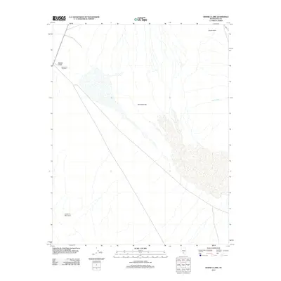
2012 Map of Bonnie Claire
USGS Topo · Published 2012About this map
Bonnie Claire stands as a primary point of interest in this desert landscape, situated at the edge of the expansive Sarcobatus Flat. The presence of the Bonnie Claire Post Office along the road network highlights the persistence of this small outpost within the high desert environment of Nye County. To the southwest, the terrain rises into the Grapevine Mountains, while the intermittent drainage of Tolicha Wash and the small watering point at Coyote Holes denote the scarce water resources of the region. This 2012 survey documents the area's sparse settlement patterns and the clear delineation between the flat valley floor and the surrounding mountain ranges.
Find a feature on this map
6 named features on this map. Tap any name to fly to it.
Don’t see what you’re looking for? This feature index may not catch every label — zoom into the map to look around manually.
Map Details
Editions of this 2012 Bonnie Claire Map
This is the sole edition of this map. No revisions or reprints were ever made.
Other maps of this area

1908 · Kawich
USGS Topo · 1:250,000

1908 · Lida
USGS Topo · 1:250,000

1913 · Lida
USGS Topo · 1:250,000

1942 · Tolicha Peak
USGS Topo · 1:125,000

1954 · Goldfield
USGS Topo · 1:250,000

1955 · Goldfield
USGS Topo · 1:250,000

1958 · Goldfield
USGS Topo · 1:250,000

1962 · Goldfield
USGS Topo · 1:250,000
1966 · Springdale
USGS Topo · 1:62,500
1967 · Bonnie Claire SE
USGS Topo · 1:24,000