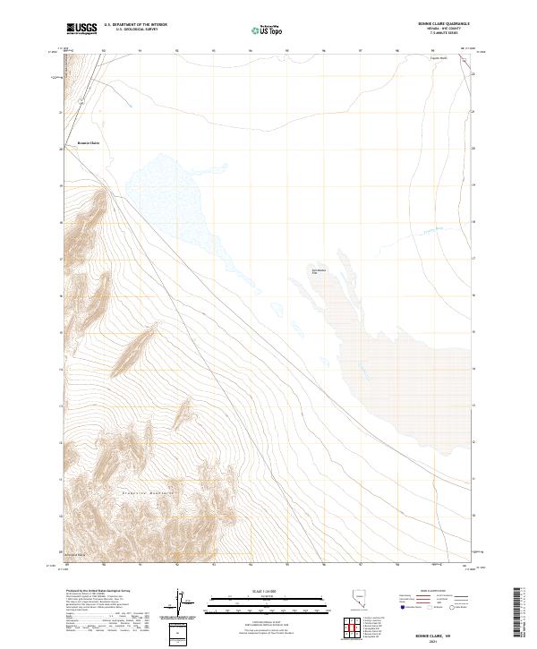
2021 Map of Bonnie Claire
USGS Topo · Published 2021About this map
Bonnie Claire serves as the primary point of human settlement in this high-desert landscape of Nye County, positioned along the edge of the Gold Mountain Range. The topography is defined by the stark transition from mountain peaks to the expansive basins of Sarcobatus Flat and the northern reaches of the Amargosa Range. Drainage patterns across this arid environment are marked by features such as Tolicha Wash and the localized Coyote Holes, indicating the scarce water sources that dictated the movement and activity of early travelers and miners in the region. To the south, the terrain rises sharply into the Grapevine Mountains, where complex contouring reveals the steep elevations characteristic of the Nevada-California borderlands. This 2021 update maintains the documented land divisions of t8s r43e and t9s r44e, providing a precise modern reference for the remote geography of the Great Basin.
Find a feature on this map
11 named features on this map. Tap any name to fly to it.
Don’t see what you’re looking for? This feature index may not catch every label — zoom into the map to look around manually.
Map Details
Editions of this 2021 Bonnie Claire Map
This is the sole edition of this map. No revisions or reprints were ever made.
Other maps of this area

1908 · Kawich
USGS Topo · 1:250,000

1908 · Lida
USGS Topo · 1:250,000

1913 · Lida
USGS Topo · 1:250,000

1942 · Tolicha Peak
USGS Topo · 1:125,000

1954 · Goldfield
USGS Topo · 1:250,000

1955 · Goldfield
USGS Topo · 1:250,000

1958 · Goldfield
USGS Topo · 1:250,000

1962 · Goldfield
USGS Topo · 1:250,000
1966 · Springdale
USGS Topo · 1:62,500
1967 · Bonnie Claire SE
USGS Topo · 1:24,000