
1968 Map of Bonny Reservoir North
USGS Topo · Published 1971About this map
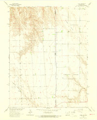
Bonny State Recreation Area and the waters of the South Fork Republican River dominate this late-1960s landscape in Yuma County. This survey captures the infrastructure of the Missouri River Basin development, highlighted by the Bonny Dam and its associated spillway. The presence of the Bonny Dam Landing Strip and a Boat Ramp near the reservoir shoreline indicates the area's established role in regional water management and recreation. Away from the water, the terrain is characterized by dry drainage patterns like Sand Creek and isolated ranching outposts such as Burr Ranch and Moellenberg Ranch. A specialized piece of irrigation history is noted near the settlement of Hale with the Hale Ditch Aqueduct, which carried water across the local topography.
Find a feature on this map
17 named features on this map. Tap any name to fly to it.
Don’t see what you’re looking for? This feature index may not catch every label — zoom into the map to look around manually.
Map Details
Editions of this 1968 Bonny Reservoir North Map
This is the sole edition of this map. No revisions or reprints were ever made.
Other maps of this area

1950 · Bonny Reservoir
USGS Topo · 1:62,500

1954 · Limon
USGS Topo · 1:250,000

1957 · Limon
USGS Topo · 1:250,000

1958 · Limon
USGS Topo · 1:250,000

1963 · Beecher Island
USGS Topo · 1:24,000
1963 · Armel
USGS Topo · 1:24,000

1963 · Wildcat Canyon
USGS Topo · 1:24,000

1968 · Idalia
USGS Topo · 1:24,000

1969 · Idalia SE
USGS Topo · 1:24,000
1971 · Hale Ponds
USGS Topo · 1:24,000