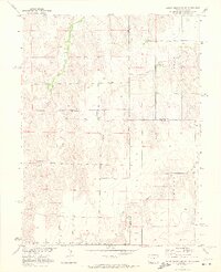
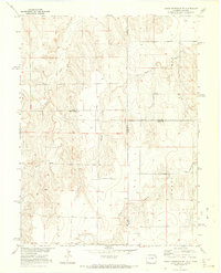
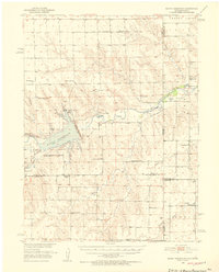
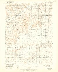
1971 Map of Bonny Reservoir SE
USGS Topo · Published 1973About this map
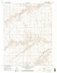
Beaver Creek and Battle Creek meander across this high plains landscape at the intersection of the Colorado and Kansas state lines. Surveyed in the early 1970s, the map reveals a remote ranching and agricultural region defined by its complex drainage network, including the southward flows of Jaqua Creek and Grant Creek. The terrain is marked by a series of draws and ridges that illustrate the hydrology of the Missouri River Basin development area. Beyond the natural watercourses, human activity is sparsely represented by scattered wells and a single Gravel Pit in the southwest. This document serves as a precise record of the topography and land boundaries during a period of systematic western water management, capturing the rural character of the borderlands where Bonny Creek and Little Beaver Creek help shape the local geography.
Find a feature on this map
12 named features on this map. Tap any name to fly to it.
Don’t see what you’re looking for? This feature index may not catch every label — zoom into the map to look around manually.
Map Details
Editions of this 1971 Bonny Reservoir SE Map
2 editions found
Other maps of this area
1950 · Bonny Reservoir
USGS Topo · 1:62,500
1952 · St Francis 3
USGS Topo · 1:62,500

1954 · Limon
USGS Topo · 1:250,000

1954 · Goodland
USGS Topo · 1:250,000

1956 · Goodland
USGS Topo · 1:250,000

1957 · Limon
USGS Topo · 1:250,000

1957 · Goodland
USGS Topo · 1:250,000

1958 · Limon
USGS Topo · 1:250,000
1966 · Ruleton NW
USGS Topo · 1:24,000

1968 · Bonny Reservoir North
USGS Topo · 1:24,000